
Climate Change

Greta Thunberg: In Response to Lies and Hate, Let Me Make Some Things Clear About My Climate Strike
"I am just a messenger, and yet I get all this hate," writes Thunberg. "I am not saying anything new,...
Read moreDetails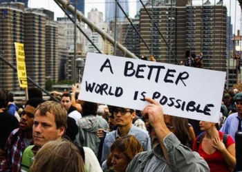
The Green New Deal is Not Enough: A Better World Is Possible
Members of this alter-globalization movement drafted a vision of a global economic system that works for both people and planet. The...
Read moreDetails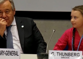
‘We Have Not Come Here to Beg World Leaders to Care,’ 15-Year-Old Greta Thunberg Tells COP24. ‘We Have Come to Let Them Know Change Is Coming’
Striking her mark at the COP24 climate talks taking place this week and next in Poland, fifteen-year-old Greta Thunberg of...
Read moreDetails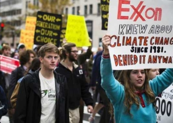
‘Wow Wow Wow… Huge News’ as New York Sues ExxonMobil for Defrauding Investors by Hiding Climate Threat
After a three-year probe and amid mounting demands that the fossil fuel industry be held accountable for driving the climate...
Read moreDetails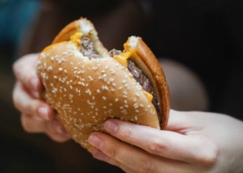
To Save the Planet From Climate Catastrophe, New Study Says Stop Eating Meat
Amid fresh warnings from United Nations researchers that there is a closing window to enact the "rapid, far-reaching, and unprecedented" societal changes...
Read moreDetails
Urging Multi-Pronged Effort to Halt Climate Crisis, Scientists Say Protecting World’s Forests as Vital as Cutting Emissions
A group of scientists urged world leaders to take immediate action to stop deforestation—calling it a key solution to stem...
Read moreDetails
‘Watershed Moment for Climate Liability’ as Rhode Island Files Historic Lawsuit Against 21 Big Oil Companies
Rhode Island has filed a lawsuit against 21 major oil companies—including BP, Chevron, ExxonMobil, and Shell—"for knowingly contributing to climate...
Read moreDetails
WATCH: History Making 3 Hurricanes At The Same Time: Hurricanes Irma, Jose and Katia
This is the first time that three hurricanes have the potential to make landfall at the same time. This satellite...
Read moreDetails
Irma Hits Barbuda as Most Powerful Atlantic Hurricane Ever Recorded
"Quite simply," wrote Eric Holthaus for Grist overnight, "meteorologists never expected a storm like Irma. The storm appears to have...
Read moreDetails


The mission of Conscious Life News is to be a global leader in the consciousness-raising of the planet.